Ironside Webinar Series: Putting Data on the Map with Location Intelligence

On October 1st, Ironside hosted a webinar on Putting Data on the Map with Location Intelligence. You will get all the key facts on location intelligence and hear a Q&A panel of Ironside developers, Ironside data scientists, and location intelligence specialists from our partner Pitney Bowes.
Topics covered include:
- Defining what location intelligence is and why you need it
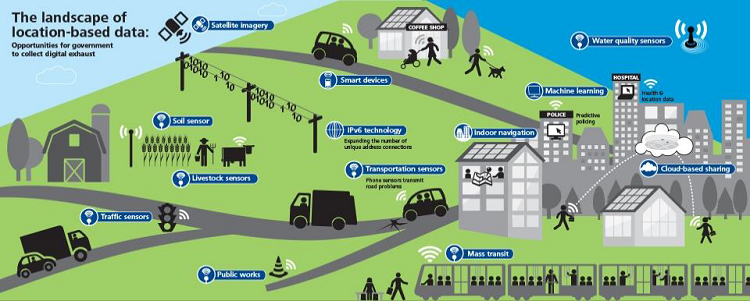
- Explaining the types of location intelligence data and where that data comes from
- Showing examples of some of the services and industries that use location intelligence
- Providing clear summaries of the use cases and distinctions you need to grasp to see how location intelligence can be applied
- Showcasing the different tools and architectures you can implement to leverage location intelligence
If you would like to learn more about Location Intelligence and Spectrum Spatial for BI, complete the form below to download the recorded webinar and a copy of the presentation deck.