Ironside and Pitney Bowes Announce Location Intelligence Partnership

Ironside is happy to announce that we have partnered with Pitney Bowes, one of the top location intelligence and data providers, to transform how our clients see, interact with, and gain insight from the location and business information to which they have access. The Pitney Bowes partnership pairs their sophisticated location intelligence technologies and comprehensive, diverse data sets with Ironside’s unrivaled analytics expertise and technical know-how to bring to market solutions that give geographic context to organizations’ historical data, provide actionable location-based intelligence in real time, and even map future trends using variables relevant to the area displayed.
“Location intelligence is important to us as it cuts clearly across each of the four pillars that make up Ironside’s business,” says Greg Bonnette, Vice President of Strategy and Innovation at Ironside. “We’re thrilled to be partnering with Pitney Bowes to fill a gap in this area and provide much-needed capabilities to some of our most important clients across key industries like finance, insurance, and consumer businesses.”
Location intelligence brings a great deal to the table in advanced analytics and data science, information management, business intelligence, and enterprise performance management, which are the “four pillars” Bonnette mentions. It provides the capability to understand the complex relationships that exist between physical places and business data, allowing for stronger, more context-sensitive decision making. This kind of functionality is crucial to any activity from planning a delivery route to forecasting the number, severity, and distribution of insurance claims in the wake of a natural disaster to predictively determining when police officers in a city need to be patrolling which areas for maximum crime prevention. Thousands of case examples like these exist in almost every public and private sector organization imaginable, which is what makes the services and tools Ironside and Pitney Bowes are offering especially relevant to modern information demands.
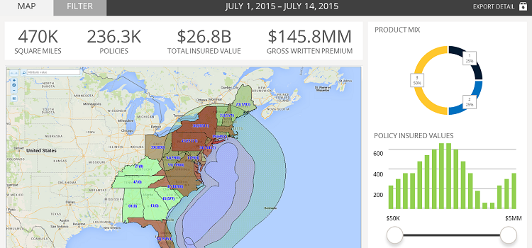
The solutions that Ironside and Pitney Bowes are creating together consist mainly of integrations with Spectrum Spatial for BI, Pitney Bowes’ platform for adding location intelligence to business analytics platforms such as IBM Cognos BI. This type of integration allows an analyst to easily take enterprise data they already have access to via BI and begin to visualize and analyze it interactively in an intuitive and customizable mapping interface. Analysts can easily display, aggregate, and drill down into details using either the interactive map or the BI tools themselves.
“What we love most about Pitney Bowes’ technology is how elegantly they’ve solved the challenge of mapping for BI,” Bonnette asserts. “They’ve managed to create a flexible, loosely coupled product that works beautifully with a number of tools but isn’t so tightly connected that it causes performance or maintainability issues with the BI platform itself. This is critical to keeping low total cost of ownership and allowing systems to do what they do best both independently and together as a unit.”
Beyond the core BI-oriented solutions, the Ironside/Pitney Bowes partnership opens up a wealth of additional opportunities in related areas of focus like advanced analytics. The rich data to which Pitney Bowes has access gives Ironside’s data scientists the sources they need to capitalize on previously unavailable data mining and modeling activities.
“Pitney Bowes has a massive catalog of high-value data sets that our experts can’t wait to utilize,” Bonnette states. “Powerful information like geodemographics and consumer expenditure indices will allow us to craft some incredibly extensive customer analytic models and industry-specific prediction capabilities. We’ll also be able to bring things full circle through Spectrum Spatial, employing capabilities like their best-in-class geocoding and route finding services. You can’t afford to get the location wrong when you’re underwriting property risk or planning a new retail location in densely populated areas, and that’s why we love how accurate Pitney Bowes’ capabilities are in this regard.”
Data means much more when placed in a real-world context, and the partnership between Ironside and Pitney Bowes will make these kinds of insights much easier for organizations to discover and act upon. If you are interested in getting more information on our Pitney Bowes partnership and the solutions it allows, please get in touch with us.
You can see this technology in action. Watch Ironside’s webinar OnDemand; Putting Data on the Map with Location Intelligence.